Early maps of the United States were made for exploration and trade, but they still reveal much about a culture’s knowledge. Historically, cartographers relied on observations and experiences to create accurate maps, often relying on indigenous peoples. They often featured illustrations of settlements, which emphasized the importance of cultural and historical knowledge. Overall, early maps of the United States show that learning was valued and necessary for navigating and understanding the new world.
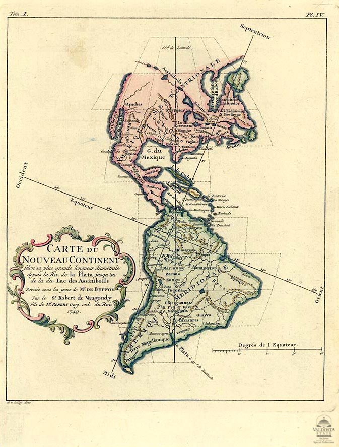
Carte de Nouveau Coninental *Map of the New World) 1749.

This Copperplate map (Carte Du Nouveau Continent) of North and South America was a product of cartographer Robert de Vaugondy, in 1749 – It is a copper engraved black and white map with the North-South and East-West axis at oblique angles to the continents. In North America, the Pacific Northwest coastline is not depicted, and a series of rivers and lakes make up a Northwest Passage. 9" x 7 1/8". This early depiction signifies a vague knowledge of the Americas. AFTB33-2
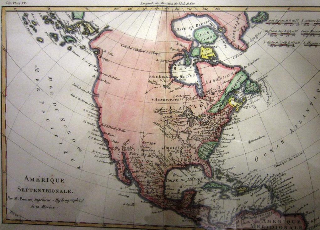
De L'Amérique Septentrionale (The United State of North America), 1787

Completed by Rigobert Bonne (1727-1795), Royal Cartographer to France, in 1773, the map shows the American east coast, including Canada.. Bonne was appointed because of his attention to detail and accuracy along with his practical aesthetics were a departure from the decorative and artistic cartography of the 17th and early 18th century. This depiction shows the growth in geographic knowledge in just 25 years from the earlier maps in this display. AFTB 65
Mappe - Monde 1787

This copperplate engraving by Royal Cartographer to France, Rigobert Bonne (1727-1795) shows North and South America. Well known for his attention to detail and accuracy, Bonne published this in Paris, in 1787. it includes James Cook’s updates for Hawaii, New Zealand, and the northwest coast of America. The United States is shown confined to the east of the Mississippi River. The increased amount of detail reveals learning from travel and interaction with indigenous peoples. AFTB64
L'Amerique 1790s

This copper plate engraving depicts North and South America. It has Napolean dating, a calendar used during the French Revolution. The map shows very little detail in the northern and western parts of North America. Cartographer: Robert de Vaugundy. 10" x 9 1/8". The areas in the east and south show greater detail which represents their knowledge of these areas of the New World. AFTB 51-3